Rindcalc Documentation
About
Rindcalc is an open source python library built on NumPy and GDAL with the goal of providing seamless raster index calculations and composites of satellite imagery for remote sensing. It looks to fill the gap left by proprietary softwares and open source initiatives alike when it comes to the need to create and process spectral index raster files.
Satellites & Imagery
- Landsat-8
- National Agricultural Imagery Program - NAIP
- Sentinel-2
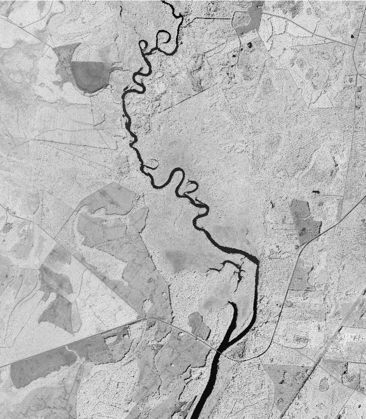
Example of use:
Calculating the ARVI of a NAIP tile and saving as a raster.
import rindcalc as rc

# set inputs and outputs
input_naip = '/naip_folder/m_3008101_ne_17_1_20151017.tif'
output_arvi = '/naip_outputs/ARVI_3008101_ne_17.tif'

data = rc.NAIP(path)
data.ARVI(output_ndvi)
- Output ARVI raster:
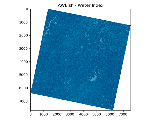
Using in conjunction with matplotlib
from rindcalc import Landsat
import matplotlib.pyplot as plt

ls = '/landsat_8/2019_11_28'
index = Landsat(ls).AWEIsh('/landsat_8/2019_11_28')
plt.imshow(index, 'ocean')
plt.title('AWEIsh - Water Index')
plt.show()
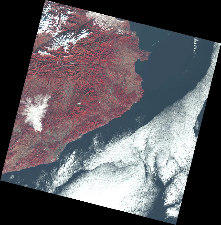
Creating a false color composite of a Landsat-8 Scene.
from rindcalc import Landsat

ls = Landsat('/landsat_8/LC08_L1TP_197031_20131212_20170428_01_T1')
ls.composite(['band_5', 'band_4', 'band_3'], '/landsat_8_outputs/FalseColor_Barcelona.tif')
- Output false color composite:
Install
With pip from PyPI repository
- Dependencies
- GDAL (v 3.0.0 or greater)
- NumPy (v 1.0.0 or greater)
pip install rindcalc
Latest development version
For latest version clone the Rindcalc GitHub Repository and add the module to path with sys.path.append.
| Authors: | Owen Smith, University of North Georgia IESA |
|---|---|
| Version: | 2.0.5 |
| License: | GPL v3.0 |